| Quantity | 3+ units | 10+ units | 30+ units | 50+ units | More |
|---|---|---|---|---|---|
| Price /Unit | $1,058.40 | $1,036.80 | $1,004.40 | $961.20 | Contact US |
 JHEMCU F405 Wing Flight Control INAV Firmware 5V 8A BEC Built-in Barometer for Fixed Wing FPV Racing Drones
$51.32
JHEMCU F405 Wing Flight Control INAV Firmware 5V 8A BEC Built-in Barometer for Fixed Wing FPV Racing Drones
$51.32
 A6 SE APM Opensource UAV Flight Control with Galvanometer Module and Note3 Ultra GPS for Pixhawk UAV Drones
$234.83
A6 SE APM Opensource UAV Flight Control with Galvanometer Module and Note3 Ultra GPS for Pixhawk UAV Drones
$234.83
 CUAV NEO 4SE High Precision Navigation Opensource GPS Positioning Module for U-blox M10 Satellite Receiving
$73.67
CUAV NEO 4SE High Precision Navigation Opensource GPS Positioning Module for U-blox M10 Satellite Receiving
$73.67
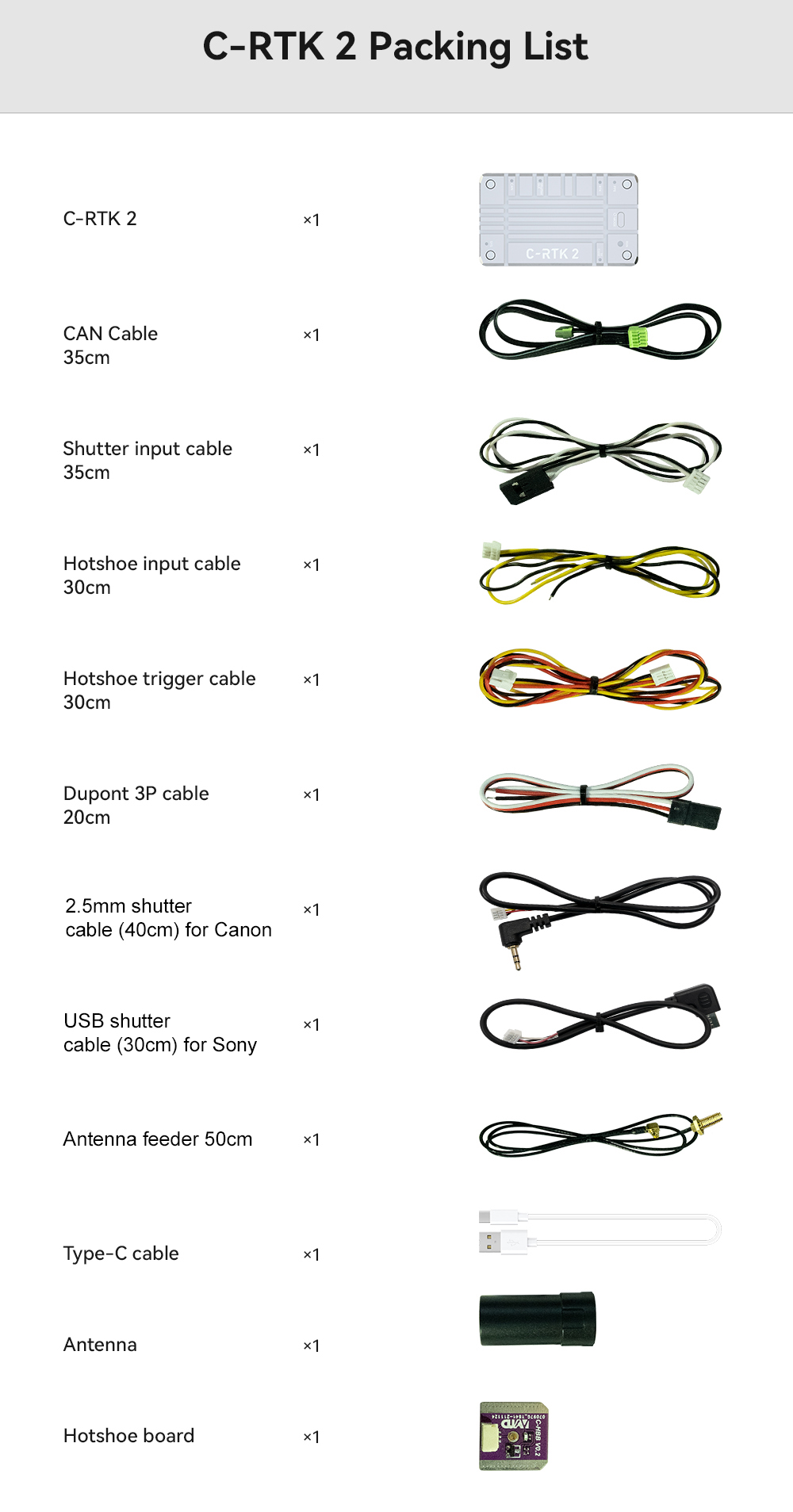
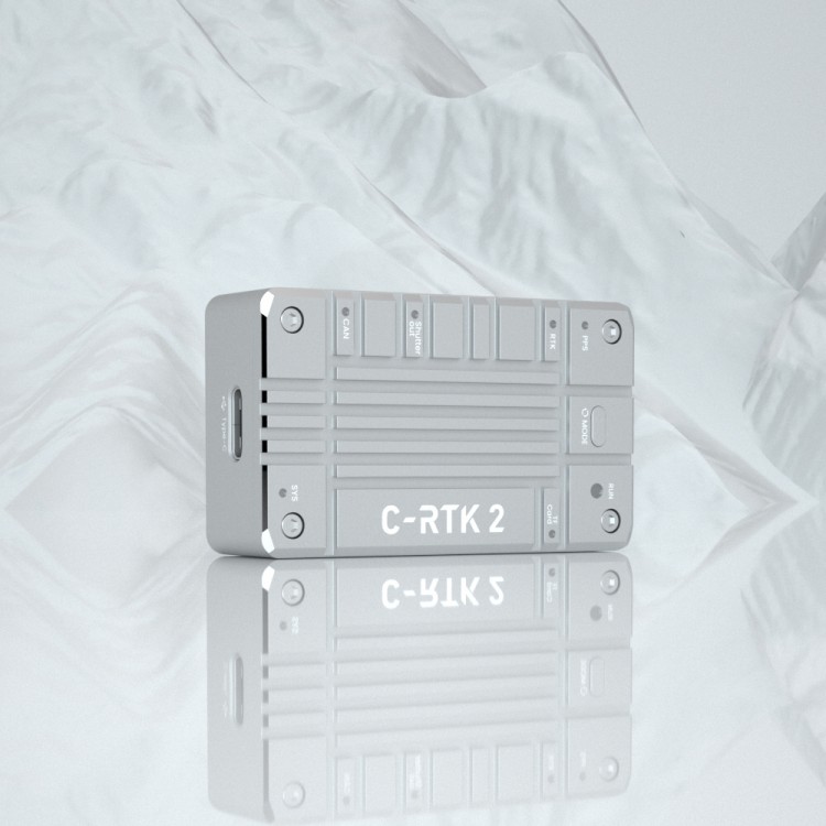
CUAV C-RTK 2 GNSS Module GPS Module of High Precision for UAV Agricultural Aerial Survey Pix APM PX4
Description:
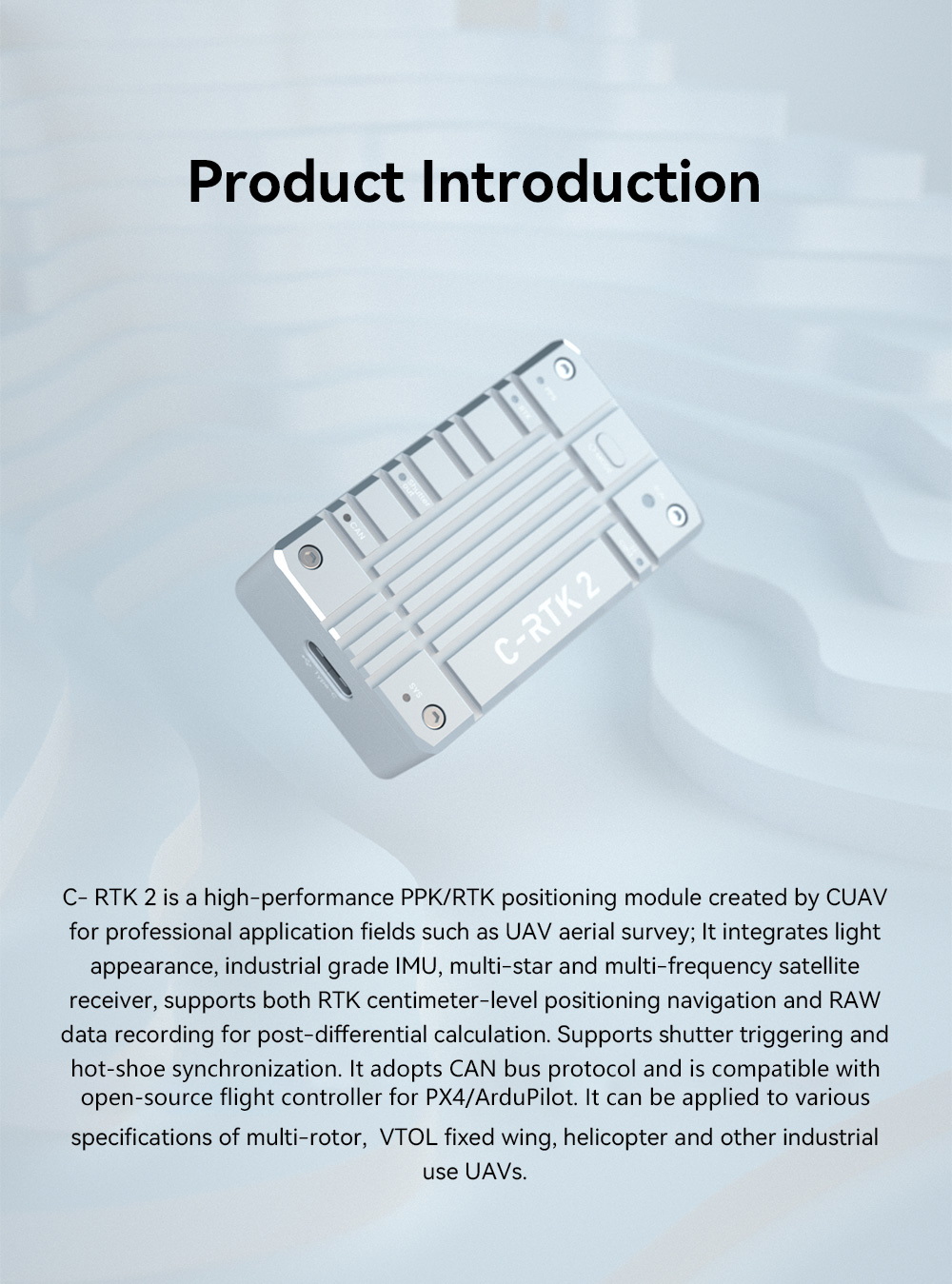
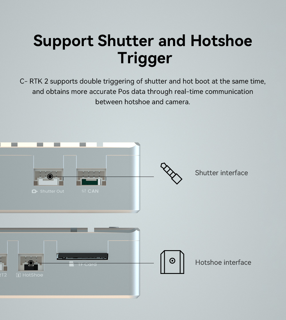
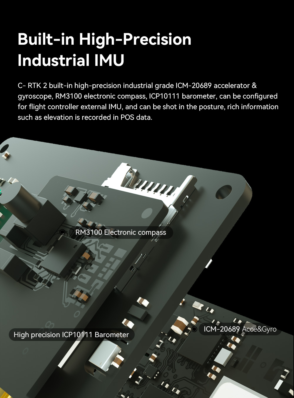
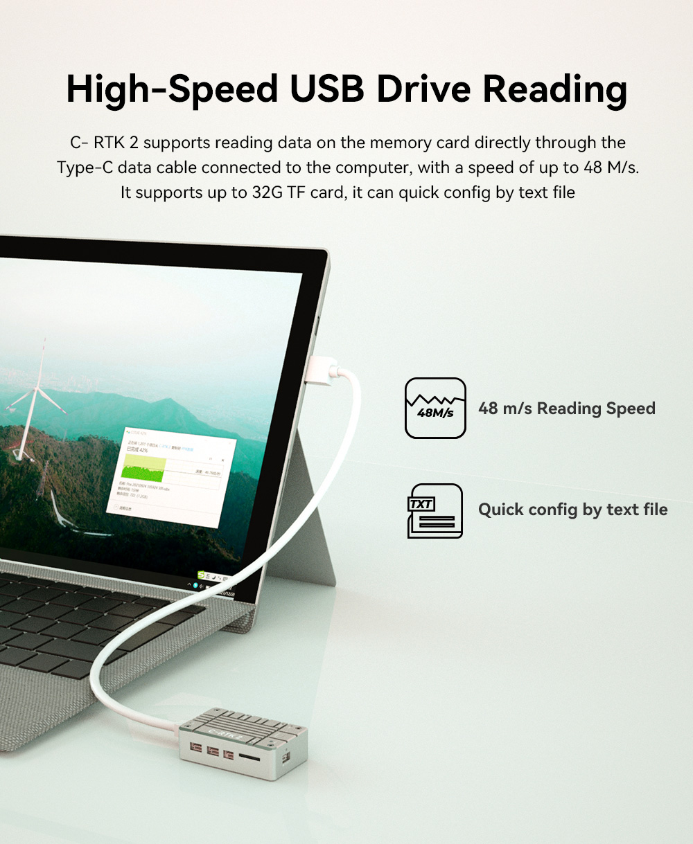
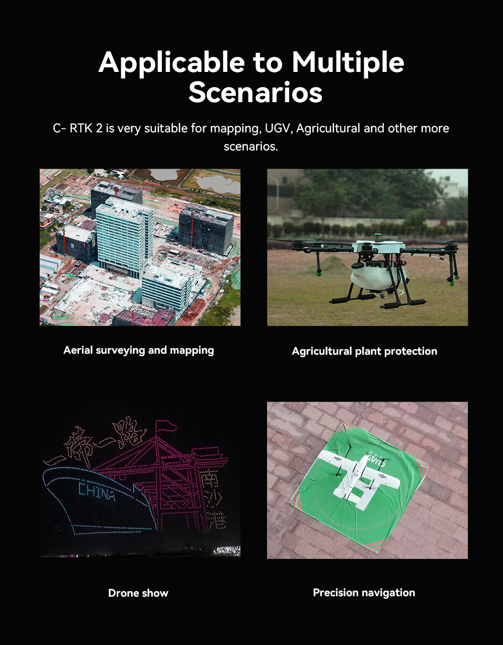
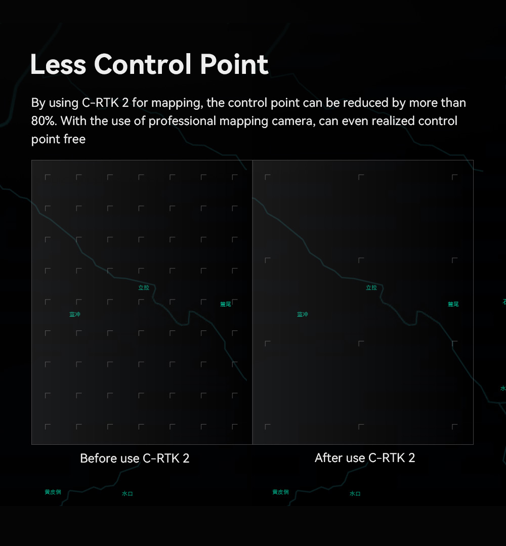
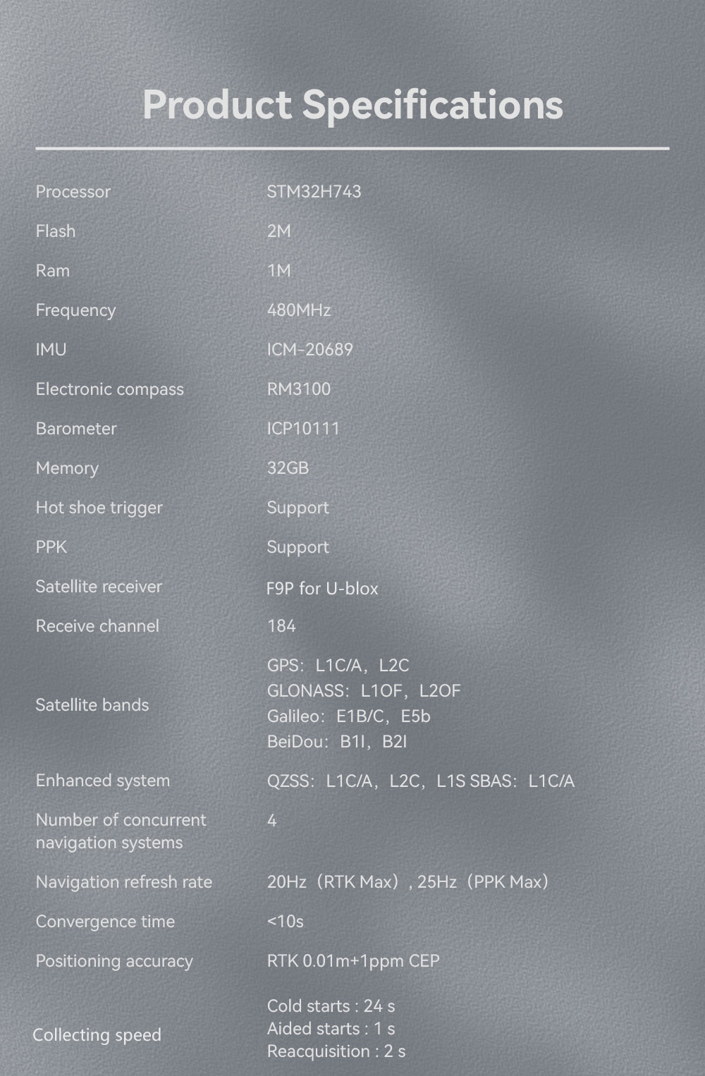
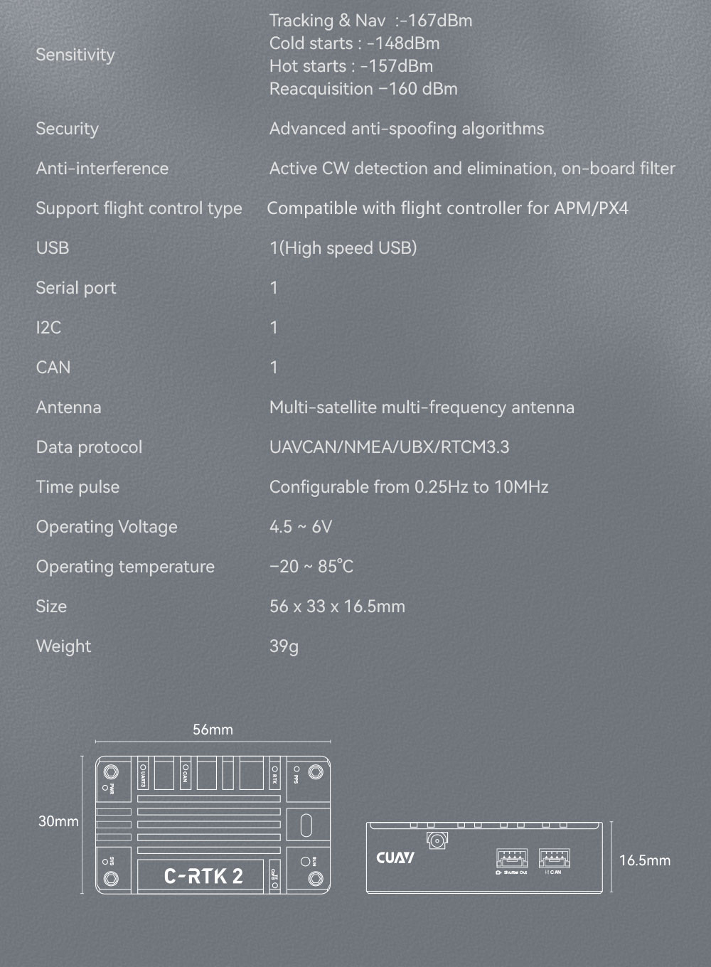
C-RTK 2 is a fully functional, cost-effective RTK module that can record raw data and shutter recording, support RTK and PPK, and can be used as a mobile station or base station.Using CAN bus communication mode, support high-speed USB and TF card storage, built-in RM3100 industrial electronic compass sensor, MS5611 barometer, ICM-42688-P Inertial navigation module module, using STM32H7 processor, running real-time system, especially suitable for aerial survey, agricultural plant protection and other application scenarios.
C-RTK 2 uses STM32H7 processor, STM32H743 processor, and for Cortex-M7core (with double-precision floating point unit), with running frequency as high as 480MHz, 2MB Flash, 1MB RAM, running real-time system, thus enabling C-RTK 2 to work efficiently and stably.
C-RTK 2 adopts UAVCAN/Drone can bus protocol; Perfect for PX4/ArduPilot; With CUAV series flight controllers. Easy plug and play can be realized.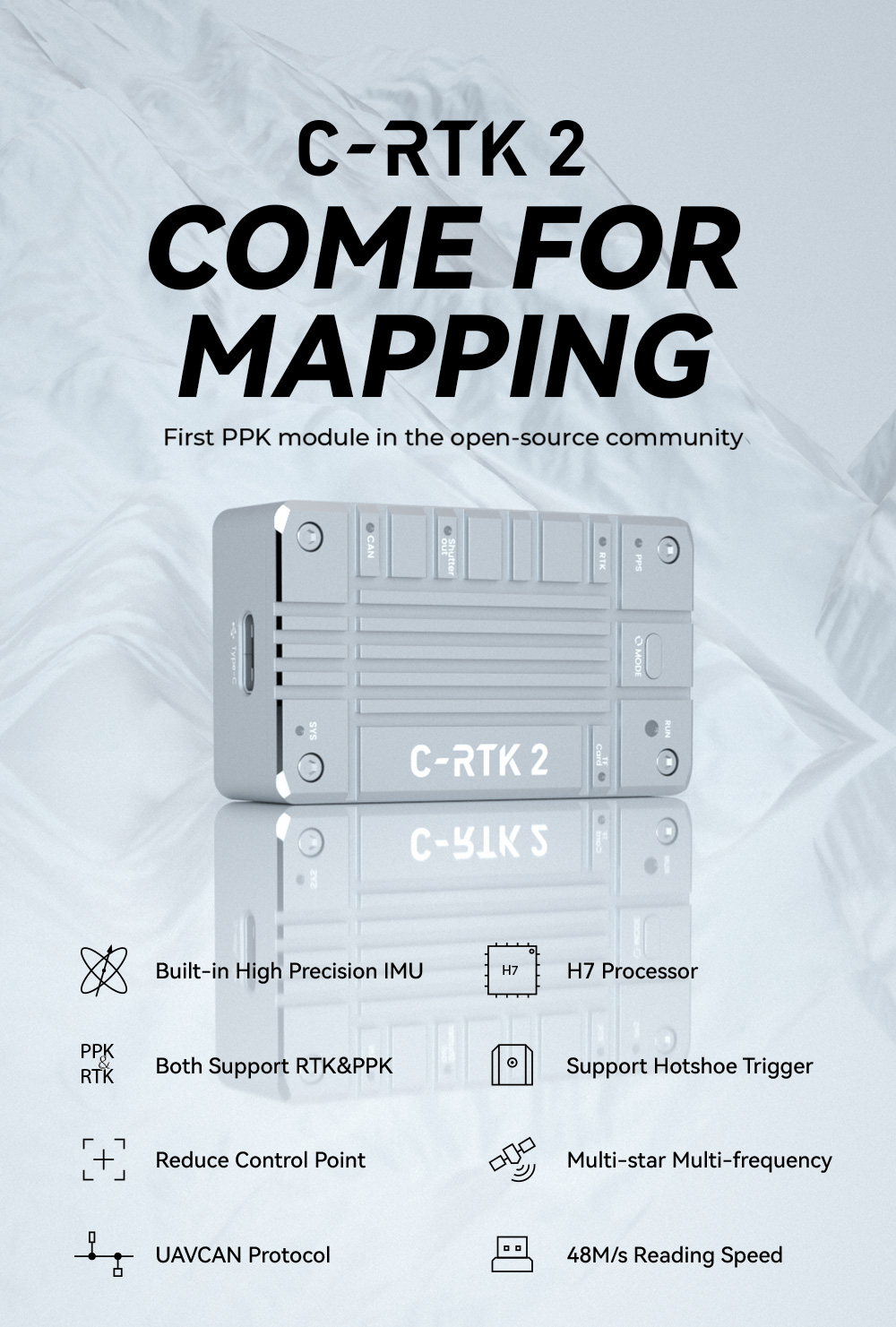


 for PX4 ArduPilot Flight Controller")
 Featuring High-Precision Navigation and Positioning")
 for PX4 ArduPilot Flight Controller")
 for PX4 ArduPilot")
")
